If you are running another OpenSpirit enabled application (or another instance of ArcGIS with the OpenSpirit Extension) there may be times when you want the cursor location in ArcGIS to be sent to the other application so it can display a tracking cursor in its own display This can be done by simply clicking on this button and then moving the mouse about on the map:
![]()
Receiving a cursor location in ArcGIS is enabled by clicking on this toolbar button:
![]()
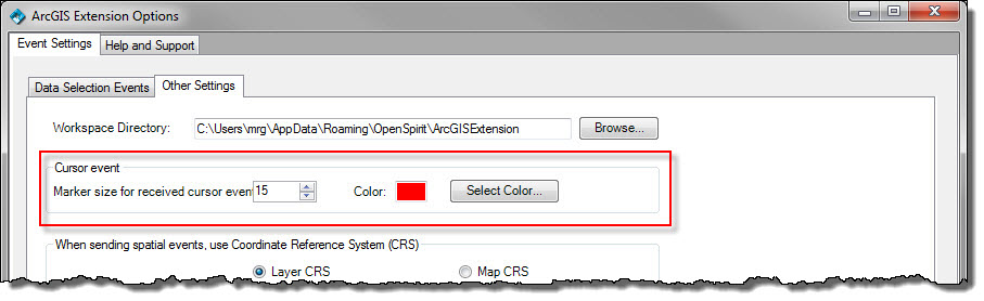
The size and color of the tracking cursor displayed in ArcGIS may be controlled by setting these options in the OpenSpirit Options dialog:
When sending a cursor location the OpenSpirit Extension sends the location in the current map display CRS along with a preferred transform to WGS84. The cursor location is NOT transformed to WGS84 but this transform is included in the OpenSpirit event for the convenience of receiving applications that have asked OpenSpirit to deliver the spatial event it its project CRS (which may have a different datum). The OpenSpirit ArcGIS Extension will attempt to get the preferred transform by reading the transforms defined in the ArcMap project (as defined earlier by the user of the project). If no appropriate transform is found the user is prompted to select a transform from a list based on the EPSG database used by the OpenSpirit coordinate service.