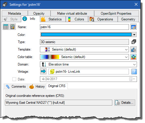
Grid data, which includes 3D surveys, seismic volumes, and horizon grids, are imported into Petrel using the data's original coordinate system. The original coordinate system can be seen by opening the data item's settings window and selecting the Original CRS tab from the Info tab.