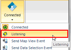
- The lightning bolt is visible on the OpenSpirit logo on the
Listening option in the
OpenSpirit dropdown menu
In the OpenSpirit integration framework events are messages that are shared between applications. By registering with OpenSpirit to send and receive various event types, applications can coordinate their actions with other applications without having to know anything about the other applications. This allows users to put together various applications to best accomplish their own workflows.
The TIBCO OpenSpirit Adapter for Petrel uses the following OpenSpirit events
Event Type |
Send or Receive? |
Description |
| Data Selection | send/receive | send / receive datakeys which represent references to data in OpenSpirit enabled data stores |
| GIS | send/receive | send / receive point, polyline, or polygon features (geometry plus attributes) with their associated CRS |
| Grid | send/receive | send / receive a grid of z values along with their associated unit & CRS |
| Map View | send/receive | send / receive the current viewport of a map window |
| Map image | receive | receive a georeferenced map image |
In order to receive events you must:
Receiving data selection events is discussed in the Import Overview chapter.
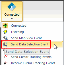
If a Petrel object has been imported or exported via OpenSpirit then it has an OpenSpirit datakey stored with it and you may then send a data selection event that references the data in the external data store. Select one or more objects in the Petrel tree and then click on the Send Data Selection Event option in the OpenSpirit dropdown menu
When the event is sent any other application, run by the same user, which is registered for listening for data selection events of this type will receive the event and read the data from the referenced data store.
Receiving GIS events is discussed in the GIS Integration chapter.
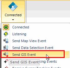
Virtually any Petrel object with a geometry that can be expressed as a set of points, polylines, or polygons may be sent as a GIS event. Select one or more objects in the Petrel tree and then click on the Send GIS Event option in the OpenSpirit dropdown menu:
 .
.
When the event is sent any other application that is registered for listening for GIS events will receive the event and make use of the selected features included in the event (e.g. ArcMap will add these features to its current map)
Receiving Grid events is discussed in the GIS Integration chapter.
Petrel surfaces are represented as regular grids and may be sent as a grid events. Select a single Petrel surface in the Petrel tree and then click on the Send GIS Event option in the OpenSpirit dropdown menu:
Map view events are used to set the zoom viewport of a mapping application to the current viewport of another mapping application. For example, a map view event can be sent from an ArcGIS map to Petrel in order to have Petrel's map window zoom to the same geographic location that is currently being viewed in the ArcGIS map.
A map view event contains information about the current viewport of a map display. The event contains the geographic locations of the corners of the portion of a map that is currently being viewed along with the coordinate system used by the map display.
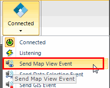
The Petrel adapter can send and receive map view events. The Send Map View Event option is found in the OpenSpirit dropdown menu:
Also in the ArcGIS Extension tool bar  and
is used to send a map view event. Clicking on the send button in Petrel
while currently viewing a map window will send a map view event. Any application
that listens for map view events, such as ArcGIS using the OpenSpirit
ArcGIS Extension, will set its current map viewport to match the viewport
of the Petrel map window. The current height and width of the receiving
application's viewport will not change, but the view limits will be set
to the same geographic locations as the sending application.
and
is used to send a map view event. Clicking on the send button in Petrel
while currently viewing a map window will send a map view event. Any application
that listens for map view events, such as ArcGIS using the OpenSpirit
ArcGIS Extension, will set its current map viewport to match the viewport
of the Petrel map window. The current height and width of the receiving
application's viewport will not change, but the view limits will be set
to the same geographic locations as the sending application.
The Petrel Adapter will only respond to map view events sent by another application if the currently active window is a map window. The Petrel Adapter will send map view events when the currently selected window is a map window and the map view event send button is pressed.
Map image events are a map view event with a georeferenced image attached
to it. The Petrel Adapter can receive map image events, but it cannot
send map image events. Map image events can be sent from ArcGIS using
the ArcGIS Extension by pressing the map image send button  in the ArcGIS Extension
tool bar.
in the ArcGIS Extension
tool bar.
Map image events are discussed in more detail in the GIS Integration chapter of this guide.