The TIBCO OpenSpirit Adapter for Petrel allows Petrel to be integrated with your GIS data and applications in a variety of ways. The TIBCO OpenSpirit Extension for ArcGIS is the most common application used to send and receive GIS events, however other applications are available that are capable of sending and receiving OpenSpirit GIS events.
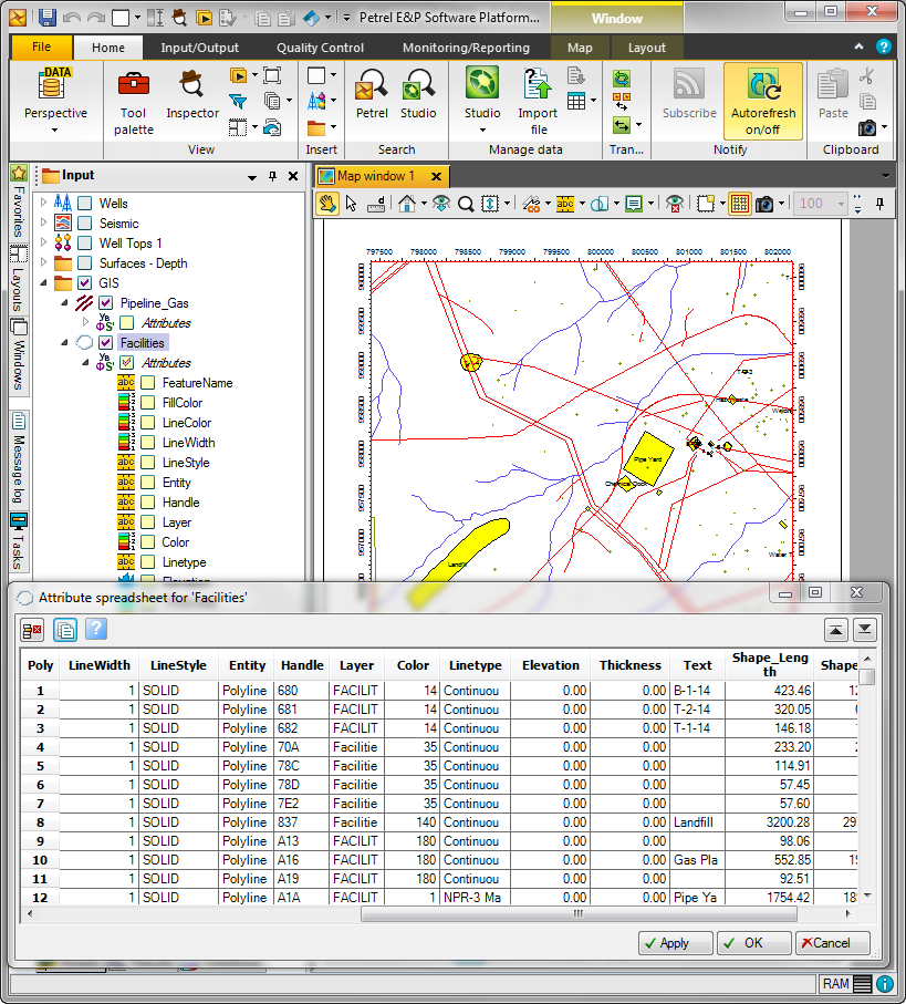
GIS events containing selected point, polyline, and polygon features can be sent from Esri's ArcGIS application to Petrel. New point, polyline, and geopolygon set objects are created in the Petrel Input tree under a new folder named "GIS". You can also send ESRI raster features from ArcGIS which will create corresponding Petrel surfaces.
The following table shows the information that can be transferred from ArcGIS to Petrel using GIS events.
ArcGIS |
Petrel |
| A feature class (e.g. Cities) | A Petrel object (either a Points, Lines/polygons, or Geopolygon Set object based on feature class geometry type) of the same name and the OpenSpirit Adapter's event options settings. |
| An individual feature (e.g. Paris, London, New York) | A Petrel object belonging to the parent Petrel object. |
| Fields on a feature (e.g. population, area, rank, etc...) | Transferred as Petrel attributes that may be posted on a map and used to control the Petrel object display properties.* |
Following is an example of how received GIS features appear in the Petrel Input tree and in a Petrel map window.
A received grid event (as may be sent from a selected raster feature in ArcGIS) creates a corresponding Petrel surface.
Received GIS and Grid events contains the data itself and no query is made to a data store. No datakey is stored with the Petrel object that is made in response to a GIS or grid event. When these events are received they are converted to the Petrel project CRS.
Map image events are an event containing a georeferenced image. The TIBCO OpenSpirit Extension for ArcGIS can create an image of the currently displayed map and send the image to Petrel. The image appears as a Petrel Bitmap image in the Petrel input tree under a folder named "Georeferenced images".
Following is an example of how a received Map Image appears in the Petrel Input tree and in a Petrel map window.
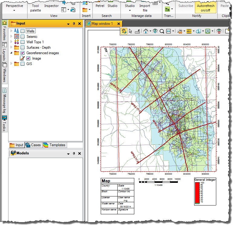
The map image can be displayed in a Petrel map window or in a 3D window. The map Z is set to the Petrel project's SRD.
You may send GIS events based on the geometry of selected Petrel objects. You may also send a Petrel surface as a grid event. Then other applications (like ArcMap with the TIBCO OpenSpirit Extension for ArcGIS) will receive these features and add them to them to its current map. This is discussed in more detail in the Event Overview.
Map view events can be sent from and received into the current Petrel map window. See the Map_View_Events section of this guide for more information about map view events.