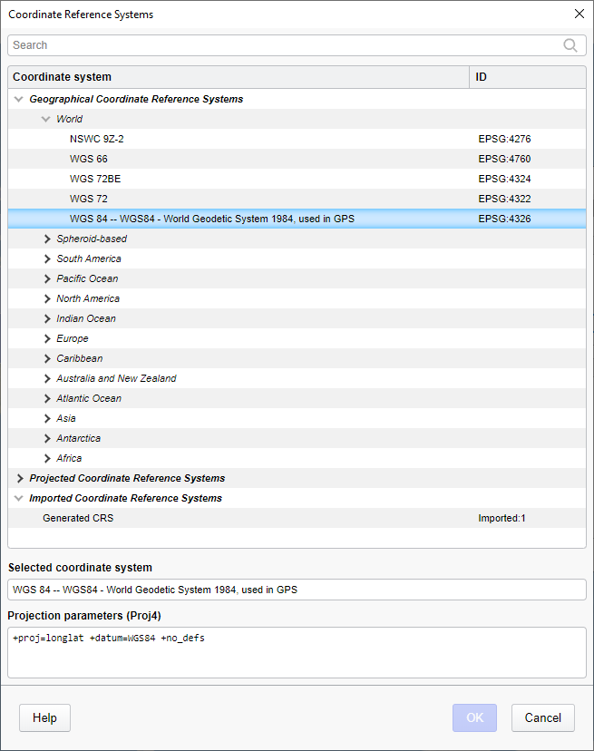
This dialog is used to select a coordinate reference system that is not available in the drop-down list of the properties page for the map chart or the settings page for the layer.
Option |
Description |
Search |
Type to search for a coordinate reference system in the list. |
Coordinate
system / ID |
Lists all the available coordinate reference systems including their spatial reference ID (EPSG code). The coordinate reference systems (CRS) are categorized as either geographical, projected, or imported. Select the CRS you want to use for the map chart or the individual layer. View tooltip for details on each listed CRS. Note: Imported coordinate reference systems appear in the list if you have added a shapefile or GeoTIFF image whose CRS definition is not already included in the list of available coordinate reference systems. Spotfire will then attempt to use the CRS definition in the added file’s linked projection information instead, and the CRS will be listed as a 'Generated CRS'. |
Selected
coordinate system |
The name of the selected coordinate reference system. |
Projection
parameters (Proj4) |
Lists the Proj4 parameters for the selected coordinate reference system, including for example the projection name and datum shift description, when applicable. For detailed information about projection parameters, please refer to the official Proj4 documentation. |
See also: