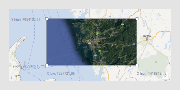
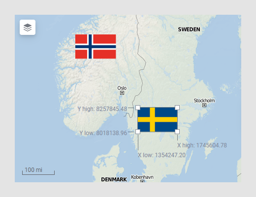
Images in image layers can be moved and resized within the map chart directly. The possibility to move images can be useful when you, as illustrated below, want to position a satellite photo on top of an ordinary map layer, or when you have a number of images to arrange on top of a map.
Note: The image and the map should use identical coordinate reference systems to match properly.
To move or resize an image:
Assume the map chart contains a map layer and an image layer containing an image.
Right-click the image, and select Edit Image Position.
Comment: The image gets a frame with handles in the corners. Coordinates for the corners are shown.
Click and drag the image to the wanted position. If you want to resize the image, drag one of the handles. This will keep the proportions of the image. To change the proportions, drag any of the borders.
Right-click the image once again, and deselect Edit Image Position.
See also the Data page, Position settings, in the Image Layer Settings dialog,
See also: