Syntax: How to Geocode an Address Line and Postal Code
GIS_GEOCODE_ADDR_POSTAL( street_addr, postal_code [, country])
where:
- street_addr
-
fixed length alphanumeric
Is the street address to be geocoded.
- postal_code
-
fixed length alphanumeric
Is the postal code associated with the street address.
- country
-
fixed length alphanumeric
Is a country name, which is optional if the country is the United States.
Example: Geocoding a Street Address and Postal Code
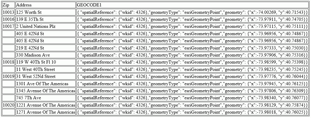
The following request geocodes a street address using GIS_GEOCODE_ADDR_POSTAL.
DEFINE FILE WF_RETAIL_LITE
GEOCODE1/A200 = GIS_GEOCODE_ADDR_POSTAL(ADDRESS_LINE_1, POSTAL_CODE);
END
TABLE FILE WF_RETAIL_LITE
PRINT ADDRESS_LINE_1 AS Address GEOCODE1
BY POSTAL_CODE AS Zip
WHERE CITY_NAME EQ 'New York'
WHERE POSTAL_CODE FROM '10013' TO '10020'
ON TABLE SET PAGE NOPAGE
END
The output is shown in the following image.
