In a map the three-dimensional earth is represented two-dimensionally, and the needed transformation can be made using different models. Each model expresses locations on earth in coordinates in a coordinate reference system. Spotfire supports more than 3000 of these systems.
Geographical coordinate reference systems define points on earth’s surface by their longitude and latitude values. The values are angles measured from the center of the earth with the zero longitude set to a certain meridian, and they form the coordinates in the coordinate reference system.
Another option of transformation is projecting the earth onto a flat surface. Locations are then transformed into x- and y values in a coordinate reference system. Different projecting models exist, resulting in different Projected coordinate reference systems.
Visualizing data in a map chart requires two specifications of coordinate reference systems, both explained below.
Coordinate Reference System for a Data Layer
When you create a map chart, you position data in a geographical context using coordinate columns available in your data table or using geocoding. In either case the data needed for the positioning is expressed in a certain coordinate reference system. For each added layer with data to position, you specify the coordinate reference system in question on the Data page of the layer’s Settings dialog.
Note: The geocoding data tables provided by Spotfire are expressed in the EPSG:4326- WGS84 coordinate reference system.
Coordinate Reference System for the Map Appearance
The projection model used for the appearance of the map, on top of which markers and features should be positioned, is also represented in a certain coordinate reference system. This coordinate reference system is specified on the Appearance page of the Properties. This means, different coordinate reference systems can be used in a single map chart. You may use one system for the map’s appearance and another system for a data layer.
Note: If you want to use Map Layers in your map chart, the Coordinate Reference System on the Appearance page must be set to EPSG:3857-WGS 84 / Pseudo-Mercator.
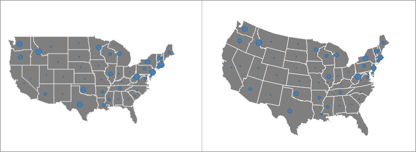
Below are examples of identical data layers (using EPSG:4326- WGS84 as coordinate reference system) that are added to map charts with different coordinate reference systems set on the Appearance page:
When another coordinate reference system than the one used for the data layer is chosen, a recalculation of the coordinates in the data layer takes place to enable correct positioning.
When setting up the map chart, you should consider which coordinate reference system that suits your needs best. All projection models cause, more or less, different types of distortions of shapes, areas, distances and directions. For example, one model may represent a certain geographical area well (like a country), but if you move away from this particular area to another part of the map, the same acceptable appearance may not be preserved. That is, you should select a coordinate reference system with minimal distortions for your particular purpose of the map, and that works well for the geographical region you want to include in the map.
See also:
Details on Coordinate Reference Systems