Adding a TMS layer
The Tile Map Service (TMS) is a widely supported map protocol. Use it to show a map background from a third party provider or to change the default map layer.
Before you begin
Tip: You can
find many TMS resources on the internet. The article
GeoAnalytics Resources on the
Community site lists many TMS resources, both free and
paid. The lists include the complete URL, copyright text, and if available,
copyright URL to specify in the TMS layer. (The Community site is free to use;
however, you must register an account to gain access to the information.)
Procedure
-
From the list, click
TMS layer.
The TMS layer is added to the Map chart layer list, and the layer with its default settings is added to the map chart.Note: If no URL has been specified, an error icon (
 ) is shown in the title bar. A TMS layer is not
valid until the URL to a valid service is supplied.
) is shown in the title bar. A TMS layer is not
valid until the URL to a valid service is supplied.
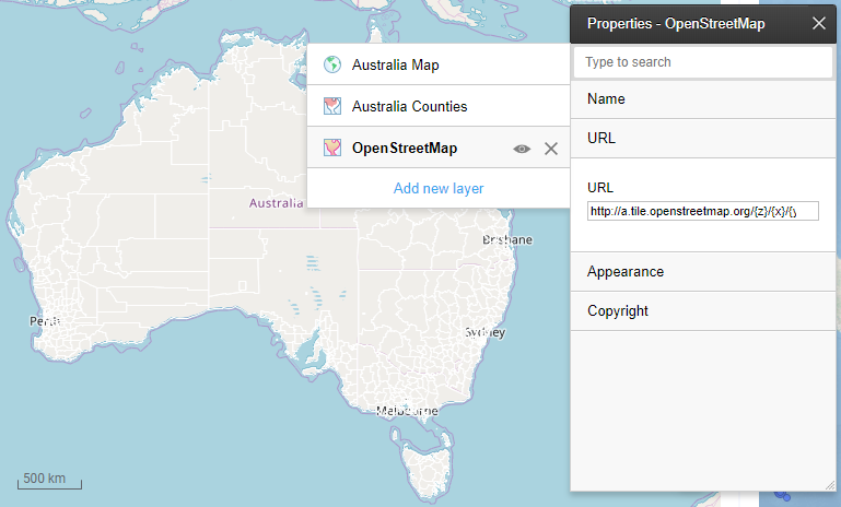
TMS layer example
In this example, the map chart has a feature layer showing the outlines of Australia counties on top of a TMS layer.
- The feature layer for Australia Counties is available in the geocoding data tables provided in the library. The transparency is set to a high degree to show outline and shading. The feature layer is the top layer of the map chart.
- The standard map layer is removed. The TMS layer replaces the standard map.
- The TMS layer is drawn from a map from OpenStreetMap, so the Title property of the layer is set to OpenStreetMap.
- The URL is set to http://a.tile.openstreetmap.org/{z}/{x}/{y}.png.